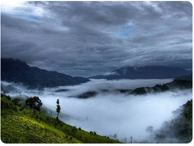
Mizoram Geography

Located in the northeast part in India Mizoram is bounded by the states of Manipur, Tripura, Assam and Manipur and shares 404 km international borders with Mayammar and a 318km boundary with Bangladesh . With an area of 21,087 sq km, is the fifth smallest state of India. Mizoram has an average altitude of 1,000 m.
Chhimtuipui, Tut, Tlawng, Tuirial and Tuiwval are the prominent rivers flowing through the hilly terrain of Mizoram. Palakdil, Rengdil, Rungdil and Tamdil are the major lakes in the state. The diverse range of soil types, including sand-loamy and clay-loamy soil, support various fruits, spices, vegetables, cotton, tea and coffee.
Climate of Mizoram

Unlike other hilly areas in the North-East India, temperature of Mizoram is not extreme. The state is known for its pleasant climate. While in winter the temperature varies between 11˚C and 21˚C in winter, in summer it ranges from 20˚C and 30˚C.
Winter in Mizoram generally lasts from November to February. Winter is followed by spring which continues till the middle of April.
The period from June to August is marked by rains. Rainfall is normally evenly distributed in Mizoram which, as a whole, gets an average rainfall of about 208 cm.
At an altitude of 2,210 metres above the sea level, Phawngpui Tlang is the highest peak in Mizoram.
Close to 91 per cent of the State area is covered by forests.
Increase in temperature
Though the mountainous state of Mizoram is blessed with a moderate climate — pleasant in summer. However, there has been an increase in temperatures in the state over the past one decade due to the rapid deforestation and unplanned urbanisation.
Mizoram’s climate is ideal for anthurium farming.